ForestSmart workflows
Support vegetation and forestry review with hosted datasets, mapped context, detections, validation status, and exportable evidence.
Use SmartData to organise forest, vegetation, corridor, rehabilitation, and environmental monitoring datasets with clear review and reporting workflows.
Mode
ForestSmart
Context
Vegetation
Review
Repeat
Forestry and environmental programs often rely on repeat captures, vegetation context, and field evidence. SmartData turns those datasets into accessible maps, review workflows, and reports.
Each capability is written around a practical SmartData workflow and linked back to the software surfaces that make it possible.
Support vegetation and forestry review with hosted datasets, mapped context, detections, validation status, and exportable evidence.
Compare repeat captures to understand growth, encroachment, land change, and management priorities.
Use 2D maps, terrain, source imagery, and annotations to make environmental conditions easier to review and communicate.
Connect vegetation context to powerlines, access tracks, boundaries, waterways, and other mapped operational constraints.
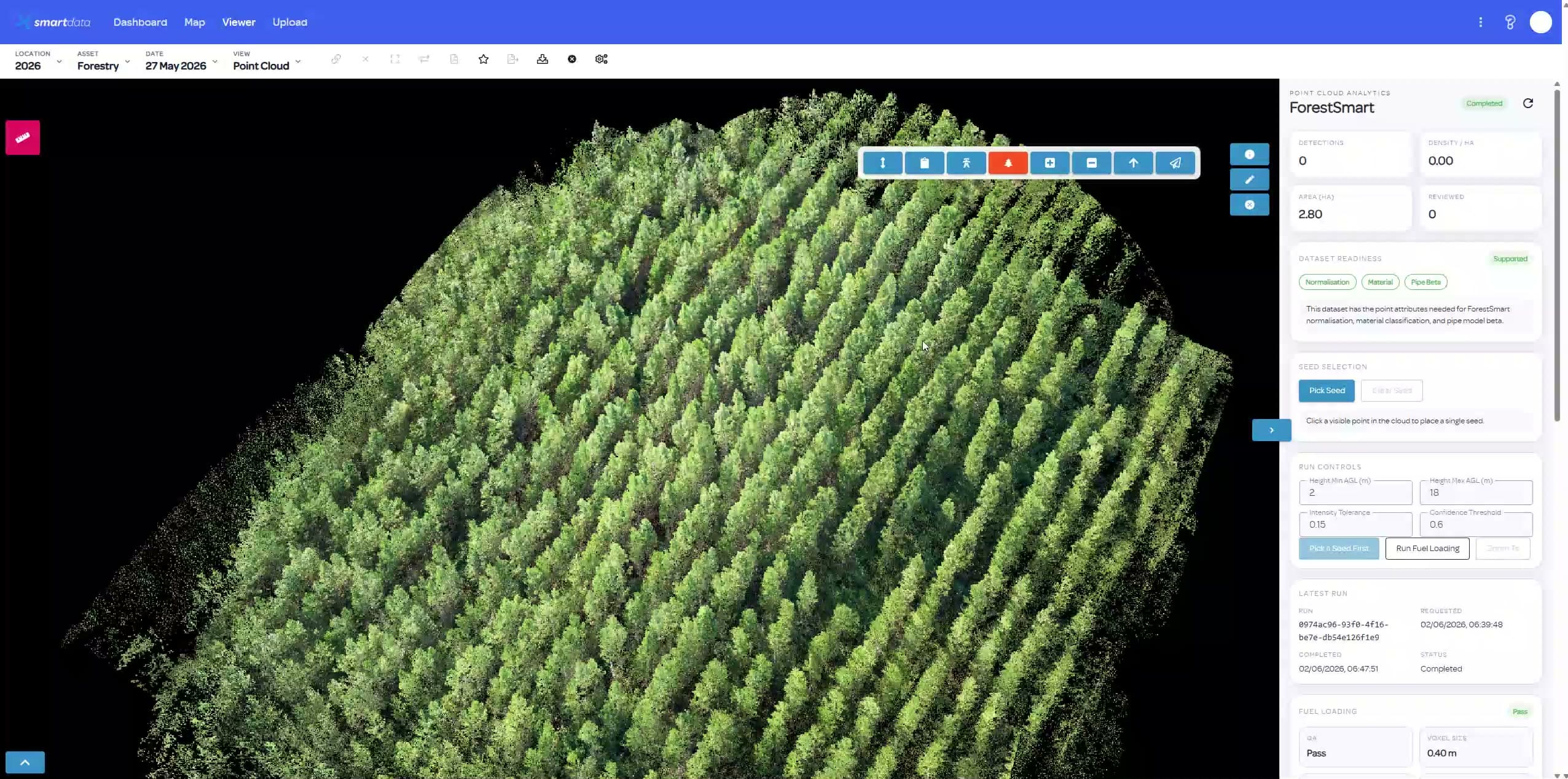
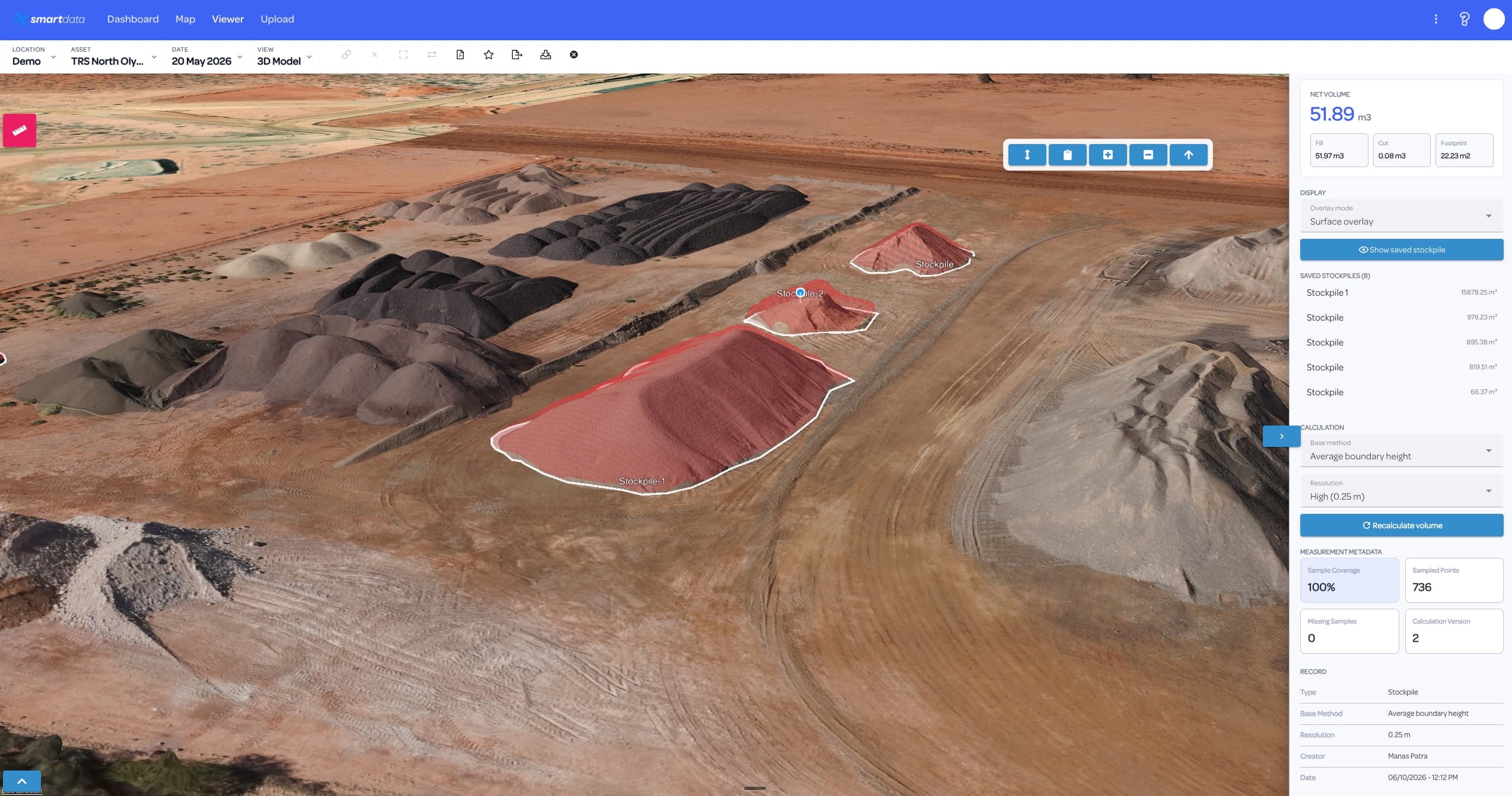
Bring point clouds, terrain, and 3D visualisation into the same workspace when elevation and structure matter.
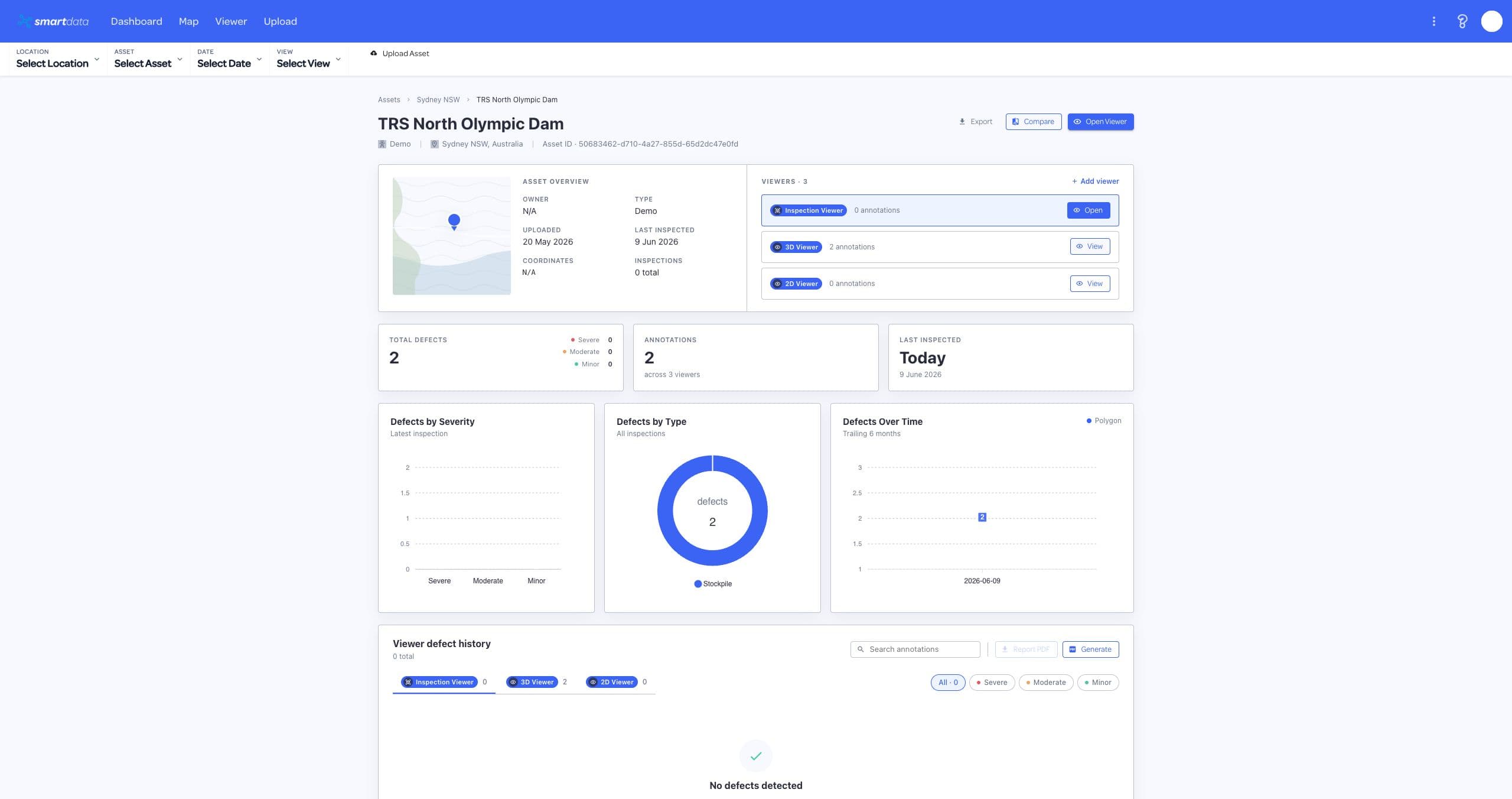
Package maps, images, annotations, and review outcomes for land managers, utilities, contractors, and regulators.
These use cases help teams quickly see whether SmartData fits their asset, site, or monitoring workflow.
SmartData is strongest when teams return to the same asset, site, or corridor over time and need evidence they can trust.
Bring maps, imagery, terrain, vegetation outputs, and supporting files into a SmartData workspace.
Validate detections, compare site state, and keep review notes tied to the mapped evidence.
Export reports and evidence for maintenance planning, compliance, rehabilitation, or stakeholder review.
These SmartData tools support the workflows most relevant to forestry & environment teams.
Review maps, terrain, vegetation, annotations, and repeat capture context for environmental programs.
View page
Use point clouds, terrain, and 3D visualisation where elevation and canopy structure matter.
View page
Coordinate datasets, review status, reporting, and stakeholders across repeat monitoring programs.
View page
SmartData workflows often overlap across asset portfolios, corridors, sites, and environmental programs.
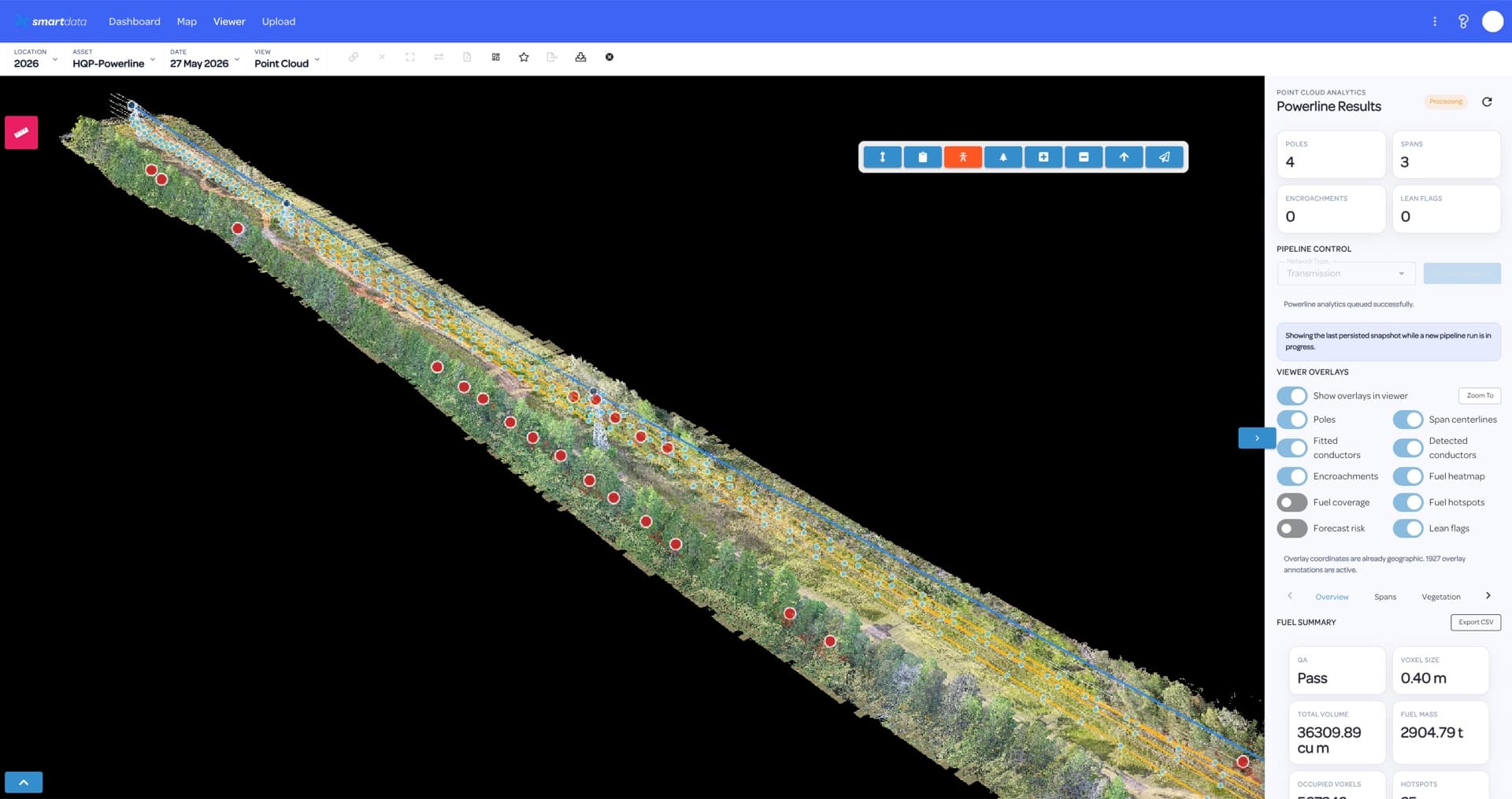
Utility teams need more than capture. SmartData keeps powerline inspection evidence, review status, spatial context, and reporting together so asset owners can move from defect discovery to planned action.
View page
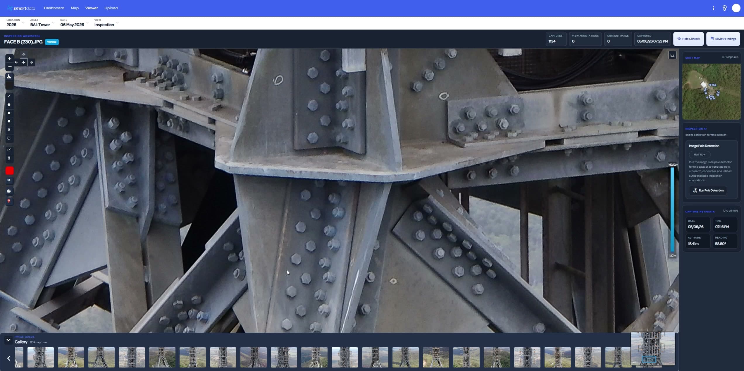
Telecommunications inspections create high-value visual and spatial evidence. SmartData helps asset owners, engineers, and contractors keep that evidence organised around the site, asset, and decision.
View page
Mining and resources teams need repeatable spatial evidence across fast-changing sites. SmartData keeps maps, measurements, models, inspection records, and reports connected to the decisions they support.
View page
Bring a sample dataset, inspection workflow, or corridor problem. We will map the right SmartData path and show where the sandbox experience can support your own asset workflow.