Mine site mapping
Host orthomosaics, terrain, imagery, and comparison views so teams can understand site state without exchanging large files.
Centralise mine site maps, terrain, stockpile evidence, 3D context, progress capture, inspections, and stakeholder reporting in SmartData.
Context
Maps + 3D
Measures
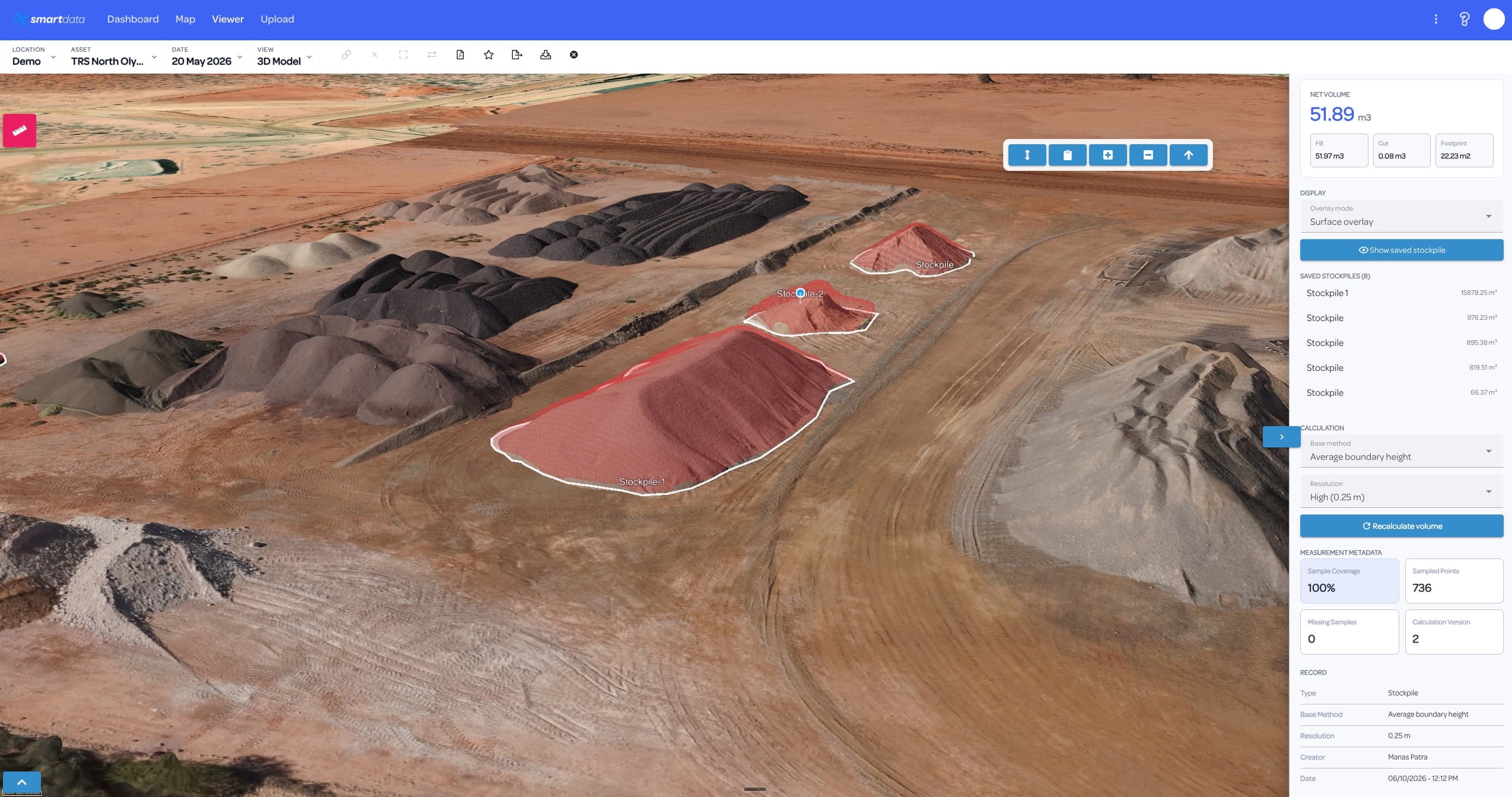
Volumes
Cycles
Repeat
Mining and resources teams need repeatable spatial evidence across fast-changing sites. SmartData keeps maps, measurements, models, inspection records, and reports connected to the decisions they support.
Each capability is written around a practical SmartData workflow and linked back to the software surfaces that make it possible.
Host orthomosaics, terrain, imagery, and comparison views so teams can understand site state without exchanging large files.
Use drone-derived spatial data to support stockpile, earthworks, access, drainage, and landform review workflows.
Bring models, point clouds, LiDAR, and Gaussian Splat views into the browser for clearer communication around complex sites.
Compare repeat captures to track movement, progress, site condition, or rehabilitation over time.
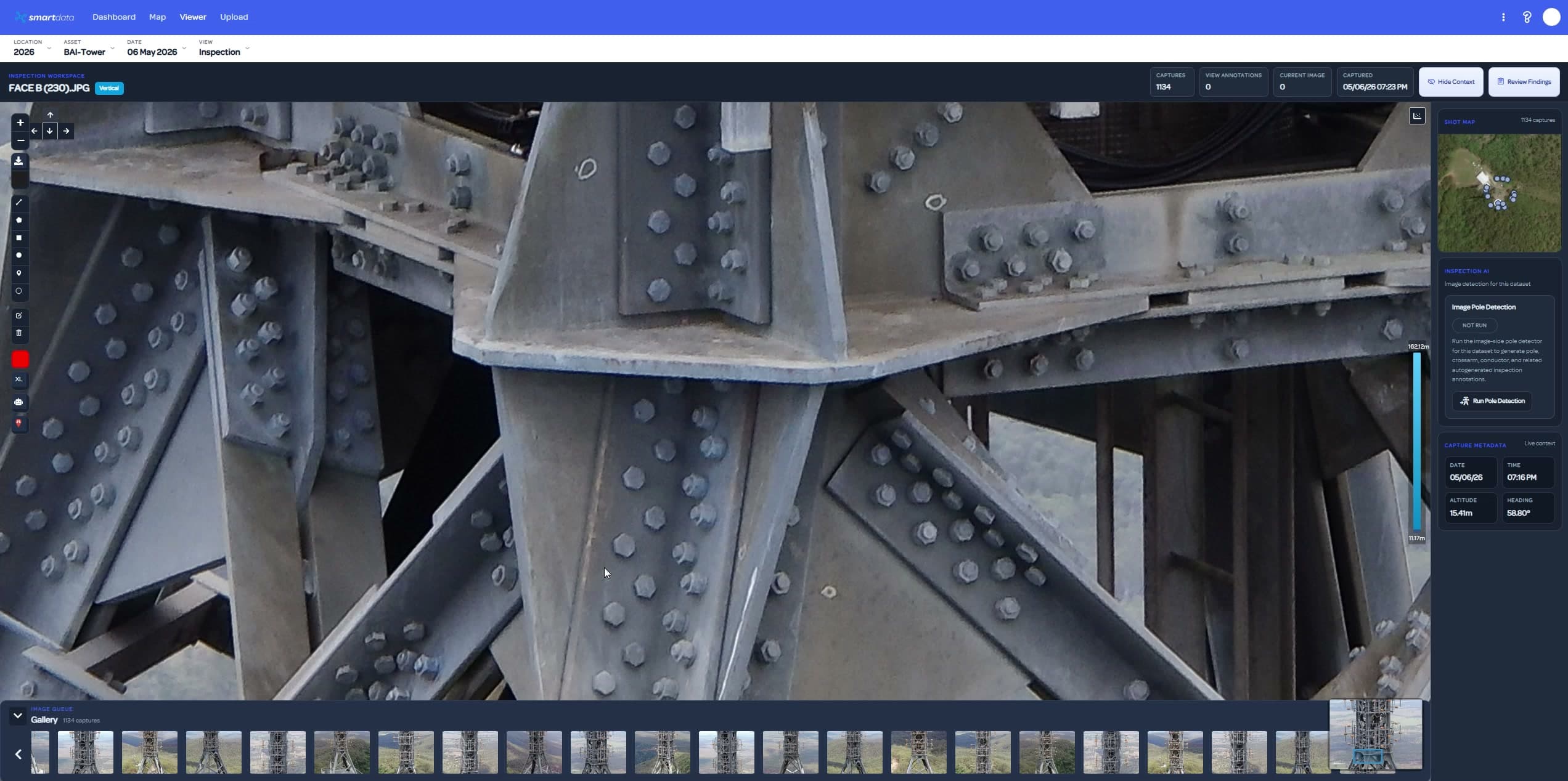
Keep high-resolution imagery, annotations, and review notes close to the mapped location and asset context.
Package site evidence for planning meetings, contractor coordination, compliance, and stakeholder updates.
These use cases help teams quickly see whether SmartData fits their asset, site, or monitoring workflow.
SmartData is strongest when teams return to the same asset, site, or corridor over time and need evidence they can trust.
Upload maps, imagery, terrain, point clouds, and 3D outputs from the latest mine site capture.
Review progress, site changes, stockpile context, access, and asset condition in a shared workspace.
Share annotated outputs and reports with operators, engineers, contractors, and management.
These SmartData tools support the workflows most relevant to mining & resources teams.
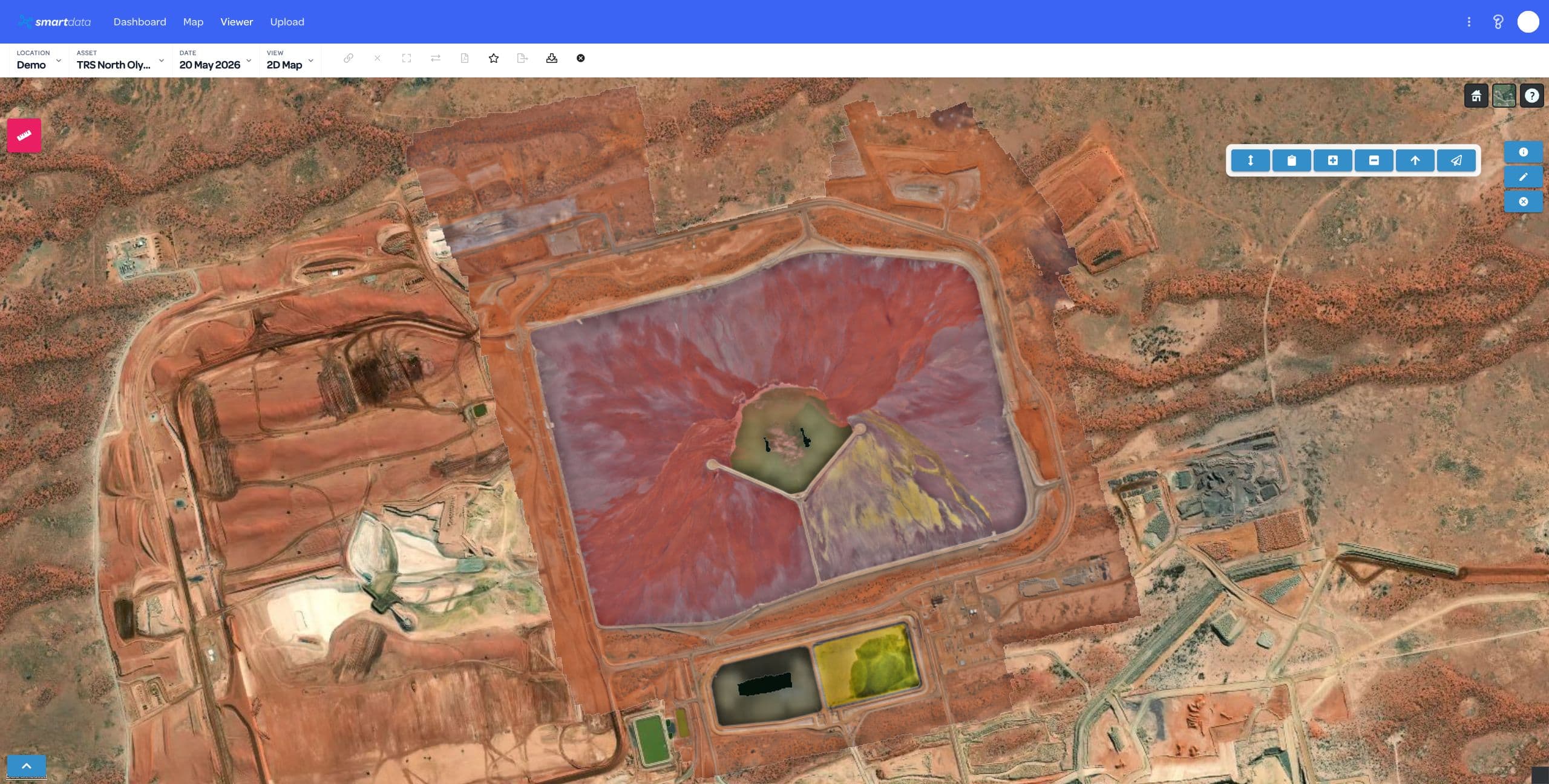
Use hosted orthomosaics, terrain views, comparison tools, and measurements for mine site context.
View page
Review point clouds, models, terrain, and splat views for complex resource environments.
View page
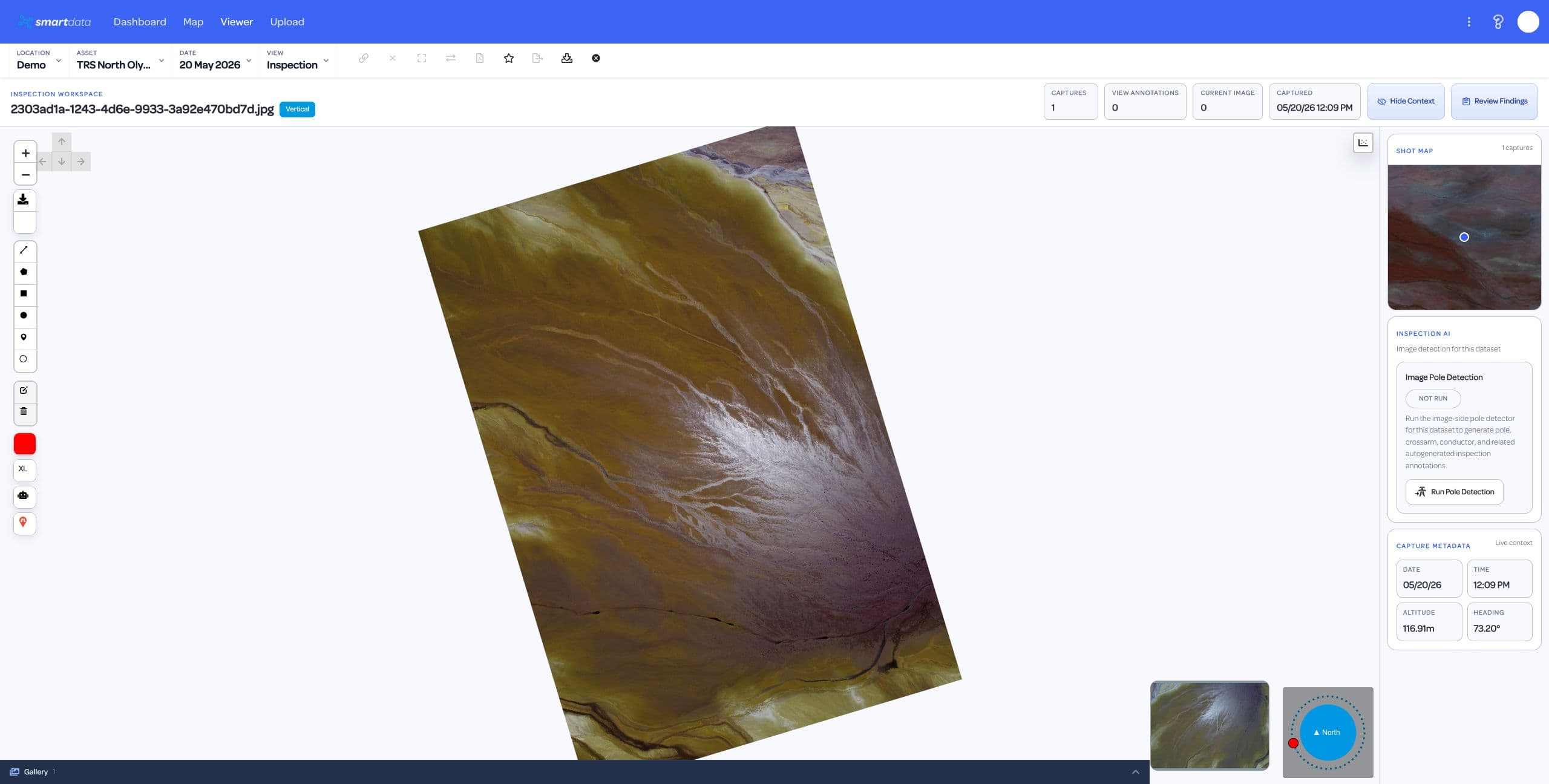
Connect source photos, annotations, review status, and reports to mapped inspection evidence.
View page
SmartData workflows often overlap across asset portfolios, corridors, sites, and environmental programs.
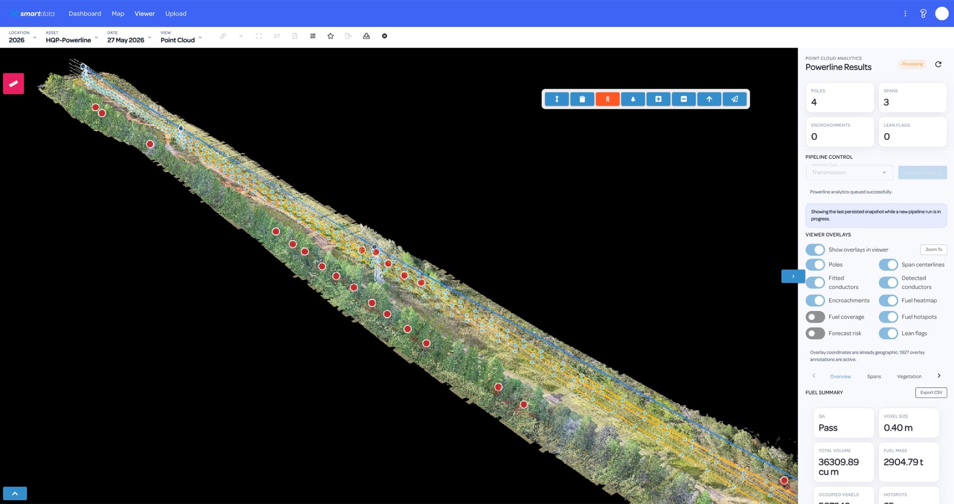
Utility teams need more than capture. SmartData keeps powerline inspection evidence, review status, spatial context, and reporting together so asset owners can move from defect discovery to planned action.
View page
Telecommunications inspections create high-value visual and spatial evidence. SmartData helps asset owners, engineers, and contractors keep that evidence organised around the site, asset, and decision.
View page
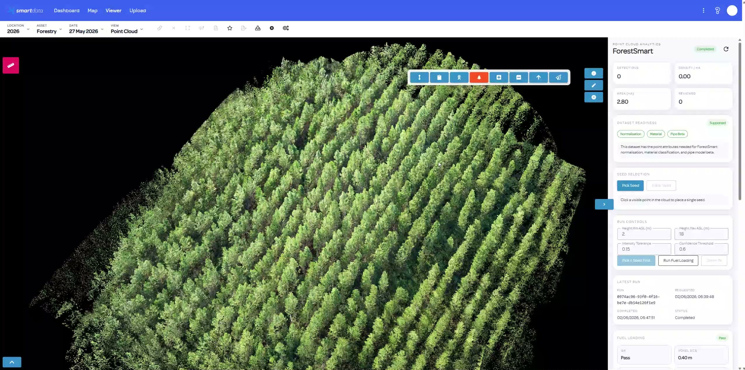
Forestry and environmental programs often rely on repeat captures, vegetation context, and field evidence. SmartData turns those datasets into accessible maps, review workflows, and reports.
View page
Bring a sample dataset, inspection workflow, or corridor problem. We will map the right SmartData path and show where the sandbox experience can support your own asset workflow.