
DJI L3 Processing
Bring your L3 mission into a shared point cloud.
Our early-access workflow prepares supported DJI L3 missions for hosted point cloud review. Check the geometry, colour and retained LiDAR attributes with your team.
Early access
Start with one complete mission. We will confirm the supported processing route and the evidence needed to assess its output.
What an evaluation will assess.
We agree on the inputs, expected outputs and quality checks before the evaluation starts.
For survey teams capturing dji l3 missions; forestry and corridor teams needing multi-return lidar; asset owners who want hosted l3 evidence in smartdata.
- Hosted point cloud review from supported L3 missions
- Colour, intensity and return attributes where the source supports them
- Georeferenced outputs with project-specific quality checks
- LAS/LAZ deliverables and a prepared browser view
- A quality report to support your review
- Retained attributes for separately scoped analysis
Attribute-rich L3 output
Review the attributes retained from a supported L3 mission.
Move between natural colour, elevation, return number, and intensity without exporting separate viewer files or losing the source attributes needed for forestry, terrain, and corridor analysis.
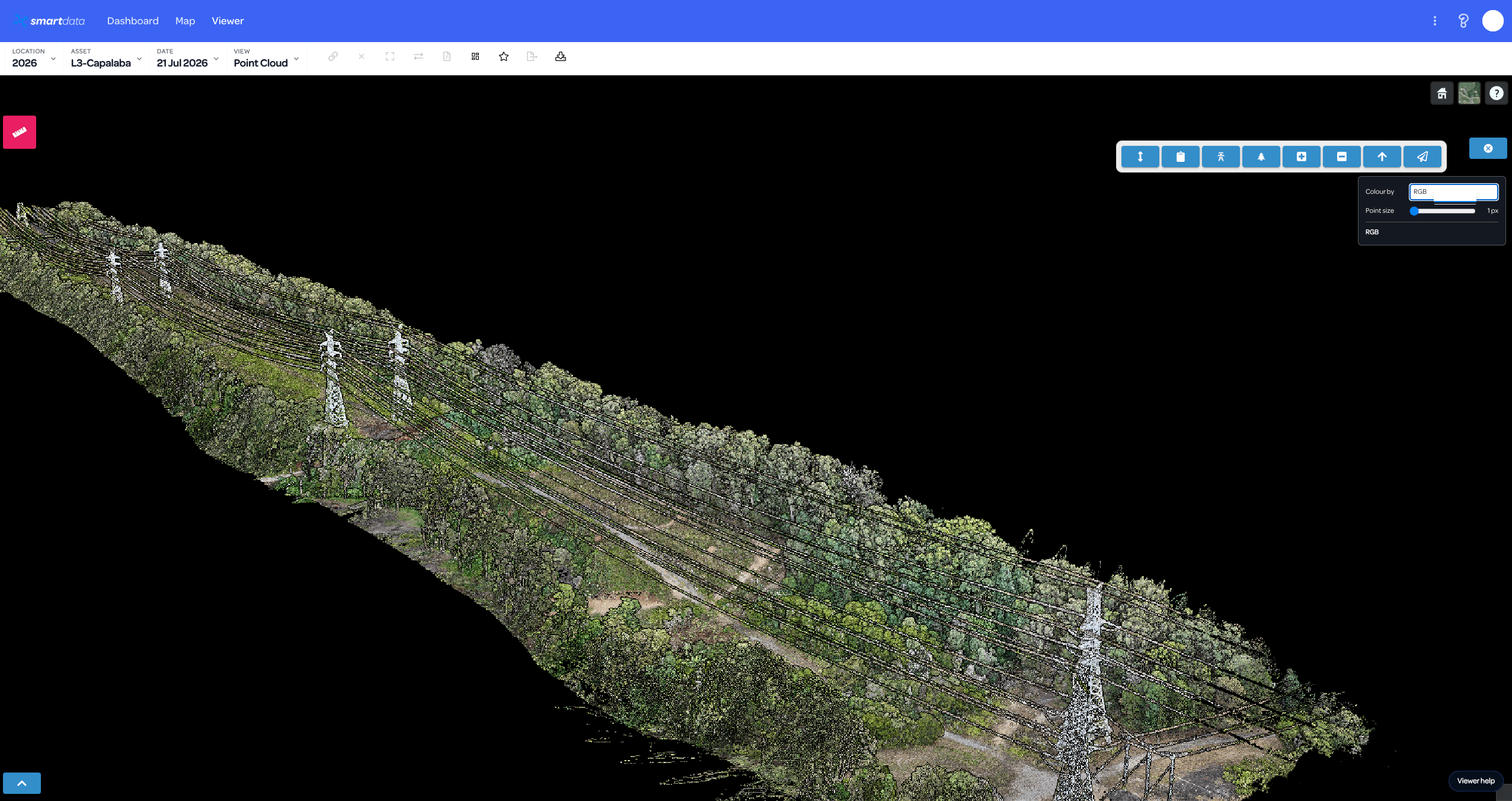
Natural-colour corridor review
Review towers, conductors, vegetation, access tracks, and terrain in a familiar colourised point cloud.
A clear first evaluation.
- Share the mission details, firmware version and required coordinate reference system.
- Confirm the complete mission package and the processing route with the team.
- Process the supported mission and check geometry, position and image coverage.
- Review the point cloud, quality notes and agreed deliverables.
Availability and data requirements
- Early access requires a supported, complete mission package.
- We confirm firmware, positioning inputs and output requirements before the evaluation.
- A universal replacement for DJI Terra is not promised. Comparison against reference deliverables can form part of the review.
Why explore this workflow?
- Review a supported processing route for your mission.
- Keep LiDAR detail available to your technical reviewers.
- Agree on quality checks before a wider data program.
Before the first project.
Can we upload any L3 mission?
This is an early-access workflow. The team must confirm your mission package, firmware and positioning inputs before processing.
Does this replace DJI Terra?
We will discuss a supported route for your mission. Some projects still need Terra deliverables for comparison or quality checks.
What will the evaluation produce?
We agree on the point cloud, retained attributes, quality report and hosted view before the evaluation. Outputs depend on the source mission.
Start with a representative dataset.
Tell us what you have and what the team needs to review. We will confirm the workflow fit and agree on the next step.